
I ran into Paul Vlasich at Shaws today , he was picking up some lunch . I had just left a River Study Meeting and wanted to inquire about this great tale of personal riches flowing to those that are just so smart that they could see 25 plus years into the Future .
That dam removal will result in expansive development for one guy!
Sorry , I am sure many were enjoying the story.
Paul invited me to stop by DPW where he is hard at work preparing the grant application.
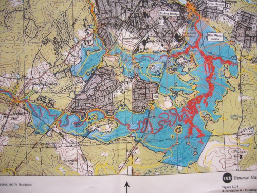
He gave me this map which is in the River Study documents. No one is going to be building anything.
Sylvia our Town Planner agrees.
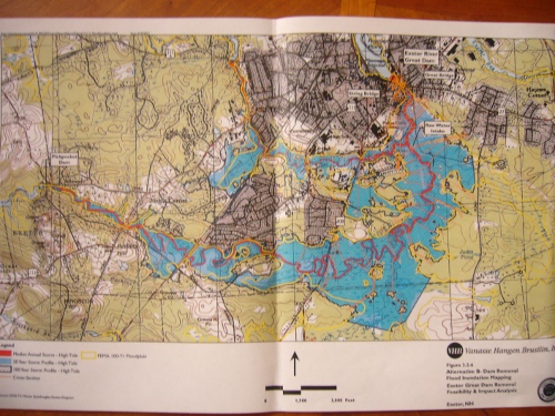
Red line delineates median annual storm-high tide.
Blue shading is the 50 year storm profile.
The yellow line is the FEMA 100 year floodplain.
The black line is 100 yr storm
This map above is existing conditions.
The map below is the Great? Dam removed.
 Mike
Mike
